


Leica Aibot v2.0 with oblique workflow

On September 2020 the new version 2.0 was released for Leica Aibot. What does this mean for surveyors?
New in Aibot v 2.0
With previous versions releases, we have focused on making the professional surveyor’s UAV workflows easier and safer while ensuring trusted survey-grade accuracy.
For example, in version 1.4 release, we focused onimproving safetyandpilot awareness通过添加安全检查和遥测数据for execution of automated missions. We also added the workflow for the ZEISS Ventum 21mm lens and a lot of small improvements to make theworkflow better for the surveyorswith, e.g. better integration between flight planning and execution and easier identification of the different missions for more efficient repeatability.
To ensure the surveyors can easily use RTK correction services, in version 1.5, we added theGNSS setup and managementto Leica Aibot skyCAPP app. Now, everything is managed in the same app from missions to settings and configurations. We also included asmoother workflow for support。Users can get all needed files in a straightforward task in case support is needed. In all releases, we have always also included numerous enhancements to ensure theaccuracy of the datais even better.
Now, it was time for a new version with a more significant leap. Among other smaller improvements, version 2.0 includes the much anticipatedoblique workflow。斜跨整个workfl设置ow: planning, execution and data processing.
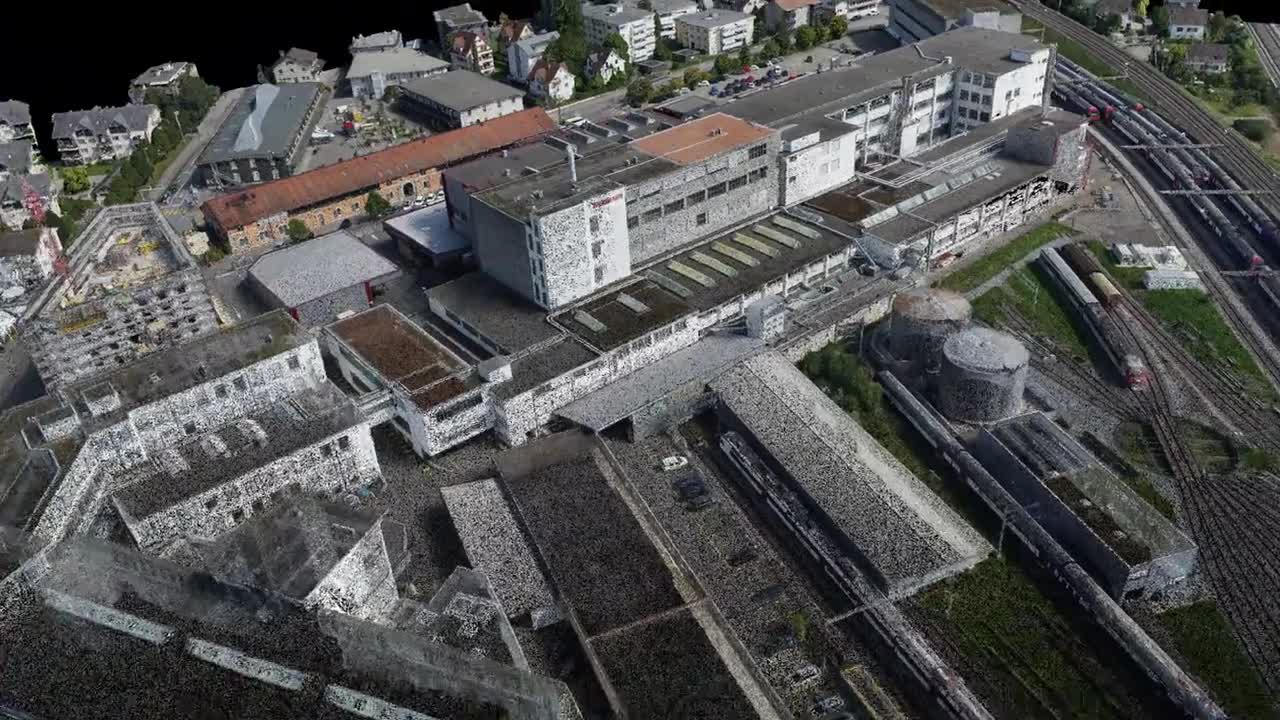
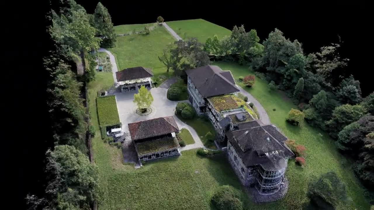
Here is a point cloud flythrough of a factory area that was captured with Aibot 2.0 in oblique and nadir.
Why do we need oblique images?
Including both oblique and nadir views together results in a more complete data set especially in areas where you have slopes, walls, vertical objects or building facades. Having the possibility to collect also oblique data reduces the need for additional technologies to collect that missing data.
Also, including oblique images to nadir projects has proven to increase the accuracy of the processed point cloud.
See data example below. A flythrough video in a point cloud that was created using nadir and oblique images collected with Aibot.
How is it done in Aibot?
Oblique imagery is now added to the same carefree workflow of Leica Aibot automated missions, and there is no need to learn a new system.
- Flight planning:Pilot simply adds new sections to the plan for each needed orientation left/right and front/back and adjusts the camera pitch angle to match the needs of the site. Because planning software knows the setup (the copter, camera and lens combinations), the planning can be defined based on different parameters such as desired GSD.
- Flight execution:Once the plan is ready and uploaded to Aibot, pilot sees all needed orientations for each flight and can execute all or some of them. Naturally, also the flight reports show the status of each orientation. With this, the pilot can trust no data is missed.
- Data processing:The flight data and images are all uploaded into Leica Infinity. Infinity processes all data into one data set and point cloud. This point cloud can be either further analysed in Infinity or exported for further use in other software.
Using this workflow, the surveyor can plan and execute their missions efficiently while ensuring the same trusted data that they expect for Leica Geosystems.
What needs to be considered?
Of course, more flight sections means more flight time and more images. The bigger the data set becomes, the more users will need processing time for results. It is good to remember that surveyor can choose which areas need to be collected also with oblique images and make the plan based on that. The rest of the area can be covered with only nadir to save time. Everything can be processed into one data set in the office, including terrestrial sensors.
Where do I get more information?
With this release we continue to develop Leica Aibot further as the UAV solution for surveyors. We strive to offer the most trusted, reliable and traceable UAV 3D data for professional surveying applications. Ability to integrate UAV as part of the existing surveying ecosystem unleashes the value of the data collected from the air.
Do you want to know more about Leica Aibot and version 2.0? Get in touch with your local Leica Geosystems contact or send us your questions throughour form。

Kontakta oss om våra UAV-lösningar
Kontakta oss för mer info om våra mät- och positioneringslösningar inom UAV.
Kontakta oss för mer info om våra mät- och positioneringslösningar inom UAV.